16 TALCOTT ROAD
Owner Information
LEONI KENNETH J & LINDA A
16 TALCOTT ROAD
NORTH EASTON, MA 02356


Property Details
16 TALCOTT ROAD is classified as a CONDO NL MDL-05 (Condominium).
The primary structure on this property was built in 2014. There are 3,582ft2 of built area within this property. There is 2,031ft2 of residential/living space within this property. This property is listed as having 5 rooms.
16 TALCOTT ROAD is valued at $439,100. The land is valued at $0 and the structures are valued at $437,000. There is an additional valuation of $2,100 on this property.
The most recent deed for 16 TALCOTT ROAD is recorded at the local registrar in Book 23049, Page 0293. 16 TALCOTT ROAD was last sold on Monday, June 20, 2016 for $509,900.
Assessment data from fiscal year 2022.
Flood Data
According to the FEMA National Flood Hazard Layer, this property does not appear to be in a flood zone. It may also be in an area not yet reviewed. Nonetheless, confirm this information prior to taking any action.
To view the flood hazards around this property, create a FEMA "Firmette" Map of the area around 16 TALCOTT ROAD.
Broadband Internet Providers
| Provider | Type | Bandwidth (mbps) | |
|---|---|---|---|
| Viasat Inc | Satellite | 100 | 3 |
| Verizon New England Inc. | DSL | 5 | 0 |
| GCI Communication Corp. | Satellite | 0 | 0 |
| HughesNet | Satellite | 25 | 3 |
| VSAT Systems, LLC. | Satellite | 2 | 1 |
| Verizon New England Inc. | Fiber | 940 | 880 |
| Comcast | Cable | 1000 | 35 |
Broadband service provider data from December 2020.
Adjacent Properties
- 30 BEAVER DAM ROAD
Single Family Residential owned by STEIN MICHAEL J - 26 BEAVER DAM ROAD
Single Family Residential owned by DOHERTY MATTHEW & KARA - 10 BEAVER DAM ROAD
Single Family Residential owned by LINDE MARK TRUSTEE - 6 BEAVER DAM ROAD
Single Family Residential owned by KEANE JAMES F JR & - 341 BAY ROAD
Single Family Residential owned by DEANE STEPHEN J & KAREN M - 345 BAY ROAD
Single Family Residential owned by DEROSA ANTHONY P & - 347 BAY ROAD
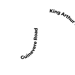
Single Family Residential owned by PUGLIA BRIAN L & JACKSON TIFFANY L - 21 KING ARTHUR ROAD
Single Family Residential owned by RAMOA SERGIO P. & STACY - 14 BEAVER DAM ROAD
Single Family Residential owned by DRISCOL KERI M. & PETER - 18 BEAVER DAM ROAD
Single Family Residential owned by DEEB PAUL M & CHERYL A - 22 BEAVER DAM ROAD
Single Family Residential owned by BELLEVUE BERTRAND & YANICK - 23 KING ARTHUR ROAD
Single Family Residential owned by MARGULIES HOWARD & CHRISTINE E. TRUSTEES - 27 KING ARTHUR ROAD
Single Family Residential owned by NEE THOMAS & CHRISTINE M (LE) - 15 KING ARTHUR ROAD
Single Family Residential owned by MULLALY PAUL H & - 9 KING ARTHUR ROAD
Single Family Residential owned by O'SHAUGHNESSY BRIAN AND AMY - 5 KING ARTHUR ROAD
Single Family Residential owned by DISCIULLO GINO & PATRICIA A - 2 MERLIN DRIVE
Single Family Residential owned by GRAFF MICHAEL A & LISA B - 6 MERLIN DRIVE
Single Family Residential owned by MACK EDWARD P & ELAINE M - 35 KING ARTHUR ROAD
Single Family Residential owned by STEWART ROBERT J & SAMANTHA - 31 KING ARTHUR ROAD
Single Family Residential owned by ROSS CAROLYN D. & REICHELT MARY TRUSTEES - 34 BEAVER DAM ROAD
Single Family Residential owned by BLACKMAN HARVEY & ESTELLE TRS - 38 BEAVER DAM ROAD
Single Family Residential owned by FRASER PAUL S & JEAN TRUSTEES